Derbyshire snow: Updated exact time snow is set to fall in Derbyshire and the Peak District including Chesterfield, Buxton, Belper, Heanor, Matlock, Dronfield and Bakewell
and live on Freeview channel 276
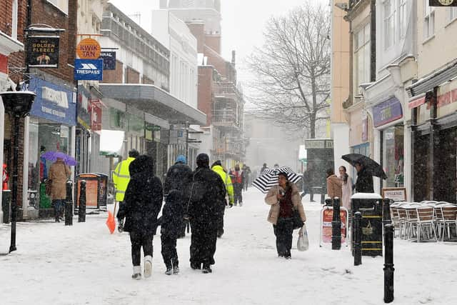
The Met Office has issued an amber weather warning for Derbyshire as heavy snow and strong winds are set to batter West parts of Derbyshire including Peak District, Matlock, Wirksworth and Ashbourne.
A yellow weather warning for snow, which covers the entire county, will also be in place from 6am tomorrow (February 8) until 6am on Friday, February 9.
Advertisement
Hide AdAdvertisement
Hide AdBelow is a full weather forecast for Thursday and Friday including the exact time when snow is forecast to fall, according to the Met Office.

Chesterfield
Thursday, February 8
12 am – 7 am – cloudy
8 am – 60% chance of snow and sleet
9 am – 70% chance of snow and sleet
10 am – 12 pm – 90% chance of heavy snow
1 pm – 2 pm – over 95% of chance of heavy snow
3 pm – 6 pm – 90% chance of heavy snow
7 pm – 70% chance of snow
8 pm – 9 pm 60% chance of rain
10 pm – 12 am – 90% chance of heavy rain
Friday, February 9
12 am – 90% chance of heavy rain
3 am – 90% chance of heavy rain
6 am – 90% chance of heavy rain
9 am – 60% chance of rain
12 pm – 40% chance of rain
3 pm – 50% chance of rain
6 pm – 40% chance of rain
9 pm – 50% chance of rain
Dronfield
Thursday, February 8
12 am – 7 am – cloudy
8 am – 50% chance of snow
9 am – 70% chance of snow and sleet
10 am – 11 am – 90% chance of heavy snow
12 pm – 3 pm – over 95% of chance of heavy snow
4 pm – 6 pm - 90% chance of heavy snow
7 pm – 70% chance of snow
8 pm –12 am - 60% chance of sleet
Friday, February 9
12 am – 60% chance of sleet
3 am – 90% chance of heavy rain
6 am – 90% chance of heavy rain
9 am – 80% chance of heavy rain
12 pm – 80% chance of heavy rain
3 pm – 40% chance of drizzle
6 pm – 50% chance of rain
9 pm – 50% chance of rain
Belper
Thursday, February 8
12 am – 5 am – cloudy
6 am – 50% chance of snow and sleet
7 am – 60% chance of rain
8 am – 60% chance of snow and sleet
9 am – 10 am – 90% chance of heavy snow
11 am – 1 pm – over 95% of chance of heavy snow
2 pm – 5 pm – 90% chance of heavy snow
6 pm – 7 pm – 60% chance of snow and sleet
8 pm – 60% chance of rain
9 pm – 60% chance of snow and sleet
10 pm – 80% chance of heavy rain
11 pm – 90% chance of heavy rain
Friday, February 9
12 am – 90% chance of heavy rain
3 am – 90% chance of heavy rain
6 am – 90% chance of heavy rain
9 am – 80% chance of heavy rain
12 pm – 60% chance of rain
3 pm – 40 % chance of drizzle
6 pm – 50% chance of rain
9 pm – 50% chance of rain
Heanor
Thursday, February 8
12 am – 5 am – cloudy
6 am – 7 am – 60% chance of rain
8 am – 70% chance of snow and sleet
9 am – 10 am – 90% chance of heavy snow
11 am – 1 pm – over 95% of chance of heavy snow
2 pm – 4 pm – 90% chance of heavy snow
5 pm – 70% chance of snow and sleet
6 pm – 8 pm – 60% chance of snow and sleet
9 pm – 10 pm – 70% chance of snow and sleet
11 pm – 90% chance of heavy rain
Friday, February 9
12 am – 90% chance of heavy rain
3 am – 90% chance of heavy rain
6 am – 90% chance of heavy rain
9 am – 50% chance of drizzle
12 pm – 40% chance of rain
3 pm – 50% chance of drizzle
6 pm – 40% chance of rain
9 pm – cloudy
Bakewell
Thursday, February 8 – Amber weather warning
12 am – 7 am – cloudy
8 am – 70% chance of heavy snow
9 am – 10 am – 90% chance of heavy snow
11 am – 1 pm – over 95% of chance of heavy snow
2 pm – 5 pm – 90% chance of heavy snow
6 pm – 7 pm – 70% chance of snow
8 pm – 70% of snow and sleet
9 pm – 60% of snow and sleet
10 pm – 70% chance of snow and sleet
11 pm – 80% chance of heavy rain
Friday, February 9
12 am – 70% chance of rain
3 am – 90% chance of heavy rain
6 am – 90% chance of drizzle
9 am – 90% chance of heavy rain
12 pm – 50% chance of drizzle
3 pm – 60% chance of rain
6 pm – 40% chance of rain
9 pm – 50% chance of rain
Matlock
Thursday, February 8 – Amber weather warning
12 am – 6 am – cloudy
7 am – 60% chance of rain
8 am – 70% chance of snow
9 am – 10 am – 90% chance of heavy snow
11 am – 3 pm – over 95% of chance of heavy snow
4 pm – 5 pm – 90% chance of heavy snow
6 pm – 7 pm – 70% chance of snow
8 pm – 10 pm – 60% of snow and sleet
11 pm – 90% chance of heavy rain
Friday, February 9
12 am – 90% chance of rain
3 am – 90% chance of heavy rain
6 am – 80% chance of drizzle
9 am – 90% chance of heavy rain
12 pm – 40% chance of drizzle
3 pm – 50% chance of drizzle
6 pm – 50% chance of rain
9 pm – cloudy
Thursday, February 8 – Amber weather warning
12 am – 4 am – cloudy
5 am – 40% chance of snow
6 am – 50% chance of snow
7 am – 60% chance of snow
8 am – 9 am – 90% chance of heavy snow
10 am – 3 pm – over 95% of chance of heavy snow
4 pm – 5 pm – 90% chance of heavy snow
6 pm – 7 pm – 70% chance of snow
8 pm – 90% of heavy snow
9 pm – 70% of snow
10 pm – 11 pm – 70% chance of snow and sleet
Friday, February 9
12 am – 80% heavy snow
3 am – 70% chance of snow and sleet
6 am – 70% chance of snow
9 am – 60% chance of snow and sleet
12 pm – 60% chance of drizzle
3 pm – 60% chance of rain
6 pm – 60% chance of heavy rain
9 pm – 50% chance of rain
Comment Guidelines
National World encourages reader discussion on our stories. User feedback, insights and back-and-forth exchanges add a rich layer of context to reporting. Please review our Community Guidelines before commenting.